
According to a comprehensive report by the Financial Times, Iran has successfully obtained and utilized a Chinese observation satellite to monitor United States military targets. This development has provided the Islamic Republic with an unprecedented capability to gather high-resolution, real-time intelligence on American troop movements and base infrastructure across the region.
|
http://buycoffee.to/przekazwiedzy You’ll motivate me to work harder and create better content. Thank you! |
The revelation highlights the growing intersection of commercial space technology and military operations, demonstrating how easily dual-use assets can fall into the hands of state actors looking to circumvent traditional sanctions and intelligence deficits.
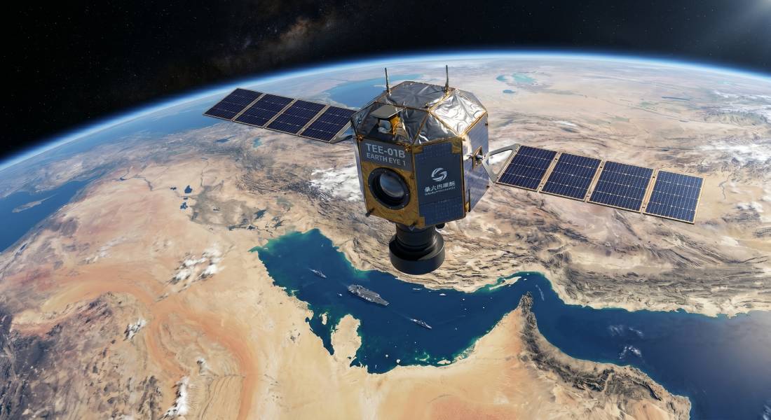
The spacecraft is the TEE-01B, also known as Earth Eye 1. Launched into space in early June 2024 from the Jiuquan Satellite Launch Center atop a Ceres-1 commercial rocket, the satellite was officially placed into a sun-synchronous orbit for environmental and agricultural monitoring. Operating at an altitude of approximately 545 kilometers, the TEE-01B is capable of capturing remote sensing images with a remarkable ground resolution of half a meter. While the manufacturer and initial operators are based in China, the lines between commercial enterprise and state-level military application were quickly blurred. Technical specifications indicate that a resolution of this caliber is more than sufficient to identify individual military vehicles, aircraft on tarmacs, and changes in base fortifications. For an actor like Iran, which has historically relied on localized drone surveillance and human intelligence, access to such a platform represents a monumental upgrade in its situational awareness.
The process by which Iran gained control over the satellite's tasking and data streams underscores the complexity of modern technology transfers. Intelligence sources indicate that the connection was established in late 2024. Rather than a direct state-to-state military transfer, which would trigger immediate international backlash and violate numerous sanctions, the arrangement was reportedly facilitated through a web of front companies. These corporate structures are closely linked to the Islamic Revolutionary Guard Corps. By posing as commercial entities interested in agricultural and topographical data, these front companies were able to secure leasing agreements or data-sharing contracts for the TEE-01B. This covert acquisition allowed the Islamic Revolutionary Guard Corps to bypass international watchdogs, effectively turning a civilian orbital asset into a dedicated military reconnaissance tool. The implications of Iran possessing a dedicated eye in the sky are profound. During recent escalations in the Middle East, the Iranian military apparatus utilized the TEE-01B to systematically track United States military bases in the region. The satellite provided not only crystal-clear imagery but also exact coordinates complete with precise timestamps. In modern warfare, the freshness of data is just as critical as its visual clarity. By knowing exactly when an image was taken, Iranian commanders could accurately map the daily routines of American personnel, note the arrival of high-value assets, and identify blind spots in base air defense networks.
This intelligence was directly channeled into the preparation of offensive operations. Reports confirm that the coordinates and imagery were used to calibrate flight paths for loitering munitions, commonly known as suicide drones, and to program guidance systems for ballistic and cruise missiles. Furthermore, the satellite allowed Iran to conduct immediate battle damage assessments. By tasking the TEE-01B to fly over a target shortly after a strike, Iranian forces could determine the success of their attacks and decide if follow-up bombardments were necessary, a capability they previously lacked and one that significantly increases the lethality of their strike packages. This incident opens a dangerous new chapter in international relations and space security. It exposes a massive loophole in the global regulation of commercial space assets. Because satellites like the TEE-01B are marketed for civilian use, their data can be bought and sold on the open market, making it nearly impossible to prevent hostile actors from exploiting them. The United States government is now faced with a complex diplomatic challenge. While there is no definitive public proof that the government in Beijing explicitly authorized the military use of the satellite by Iran, the event strains an already tense relationship between Washington and Beijing. It raises urgent questions about the oversight of China's rapidly expanding commercial space sector and the responsibility of satellite operators to vet their end-users. The United States and its allies will likely push for stricter international protocols regarding the sale of high-resolution satellite imagery, though enforcing such rules across competing global blocs remains highly problematic.
The covert utilization of the TEE-01B satellite by Iranian forces marks a watershed moment in asymmetric warfare. It proves that the monopolization of space-based intelligence by major superpowers is coming to an end. As commercial space technology becomes cheaper and more accessible, regional powers and state-sponsored organizations will increasingly look to the stars to gain a tactical edge on the ground. For the United States military, the reality that its remote bases are constantly being watched from orbit necessitates a fundamental rethinking of operational security, camouflage, and air defense strategies in the Middle East and beyond.
SOURCES:
https://www.ft.com/
https://www.investing.com/news/world-news/iran-used-chinese-spy-satellite-to-target-us-bases-ft-reports-4614200
https://www.timesofisrael.com/liveblog_entry/iran-used-chinese-spy-satellite-to-target-us-bases-ft-reports/
https://www.zawya.com/en/world/middle-east/iran-used-chinese-spy-satellite-to-target-us-bases-ft-reports-nx2837je
https://www.lbcgroup.tv/news/middleeastnews/924882/iran-used-chinese-spy-satellite-to-target-us-bases-ft-reports/en
https://satellitemap.space/sat/60012
https://www.galactic-energy.cn/index.php/Show/cid/24/aid/241
https://orbitalfocus.uk/Diaries/Launches/GeoSS/ss-Age.php
 Polski (PL)
  English (United Kingdom)